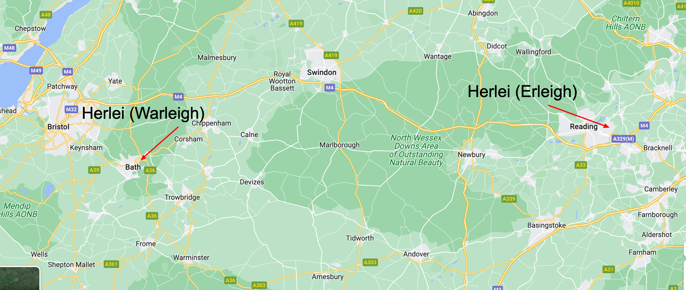
In the 1086 Domesday Book, there are two different lands that both have the same name.
Herlei in Somerset and Herlei in Berkshire

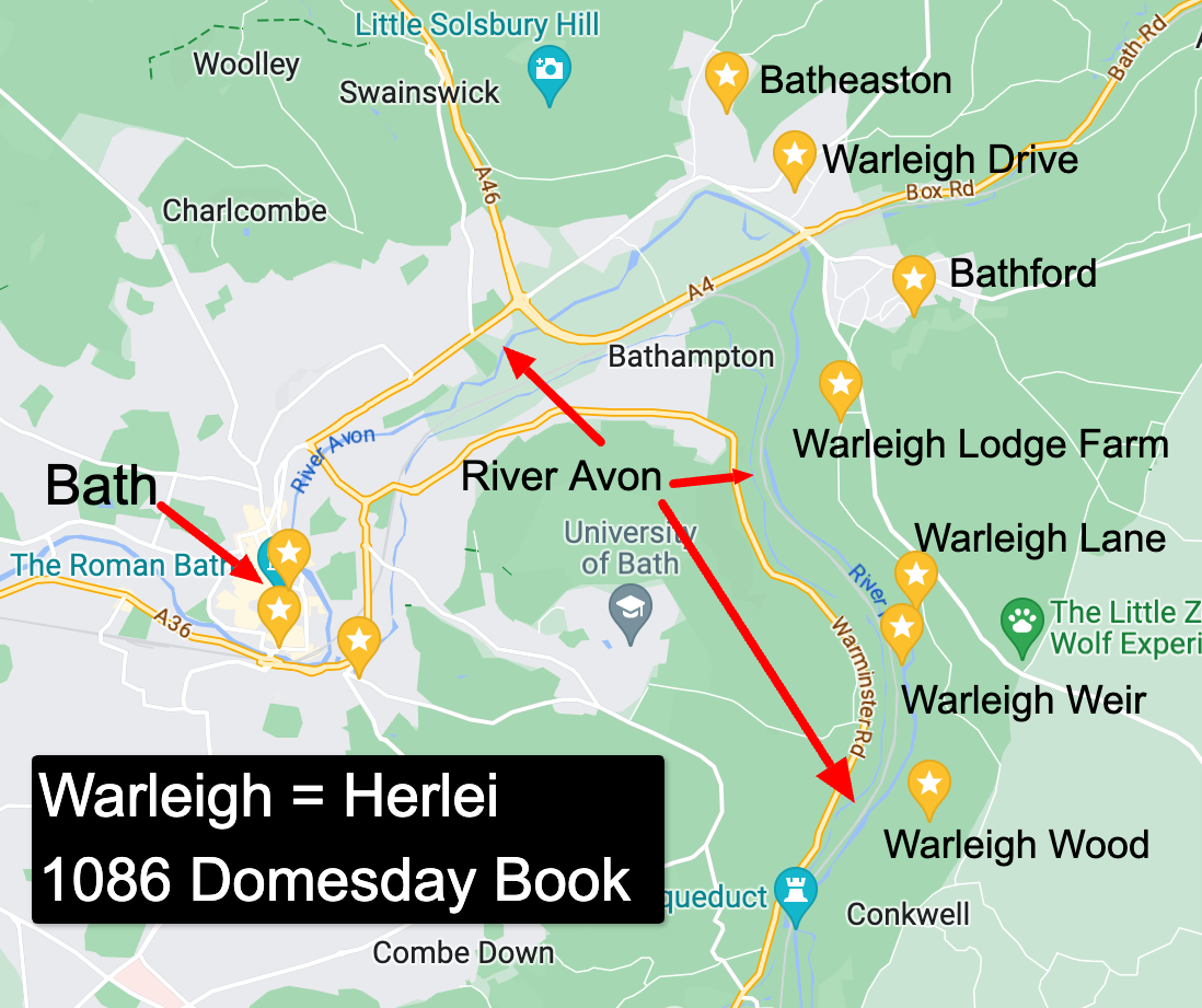
In the 1086 Domesday Book, the land in Somerset called “Herlei” was located near Bath, which is modern-day Warleigh.

Herlei (latin) or Heorleia, as it is recorded, was under the control of Azor in 1066, and then Hugolin the Interpreter in 1086.
Warleigh was a settlement in Domesday Book, in the hundred of Bath and the county of Somerset.
It had a recorded population of 8 households in 1086, putting it in the smallest 40% of settlements recorded in Domesday.
Households
Households: 1 villager. 5 smallholders. 2 slaves.
Land and resources
Ploughland: 3 ploughlands. 2 lord’s plough teams. 1 men’s plough teams.
Other resources: 0.5 lord’s lands. Meadow 0.5 acres. Woodland 3 * 3 furlongs.
Livestock
Livestock in 1086: 100 sheep.
Valuation
Annual value to lord: 2 pounds 10 shillings in 1086; 2 pounds 10 shillings when acquired by the 1086 owner.
Owners
Lord in 1086: Hugh the interpreter.
Lord in 1066: Azur.
Nearby Places mentioned on the same page in the Domesday Survey:
- Adber, 10 households
- Babcary, 24 households
- Batheaston, 48 households
- Brockley, 13 households
- Buckland [Dinham], 23 households
- Buckland [St Mary], 8 households
- [Chew] Stoke, 12 households
- Claverton, 15 households
- Combe [Hay], 14 households
- Crandon, 5 households
- Dinnington, 9 households
- Discove, 3 households
- Dodington, 11 households
- Draycott, 0 households
- Eastrip, 3 households
- Foddington, 13 households
- Haselbury [Plucknett], 26 households
- Hawkwell, 8 households
- Holton, 6 households
- Knowle [Park], 11 households
- [Lower and Upper] Swainswick, 11 households
- Otterhampton, 18 households
- Preston [Plucknett], 9 households
- Rode, 39 households
- Sandford [Orcas], 23 households
- Scepeworde, 0 households
- Stocklinch [Ottersey and St Magdalen], 23 households
- Tadwick, 8 households
- Timsbury, 18 households
- Tuxwell, 10 households
- Warleigh, 8 households
- [West] Lydford, 26 households
- Writhlington, 11 households
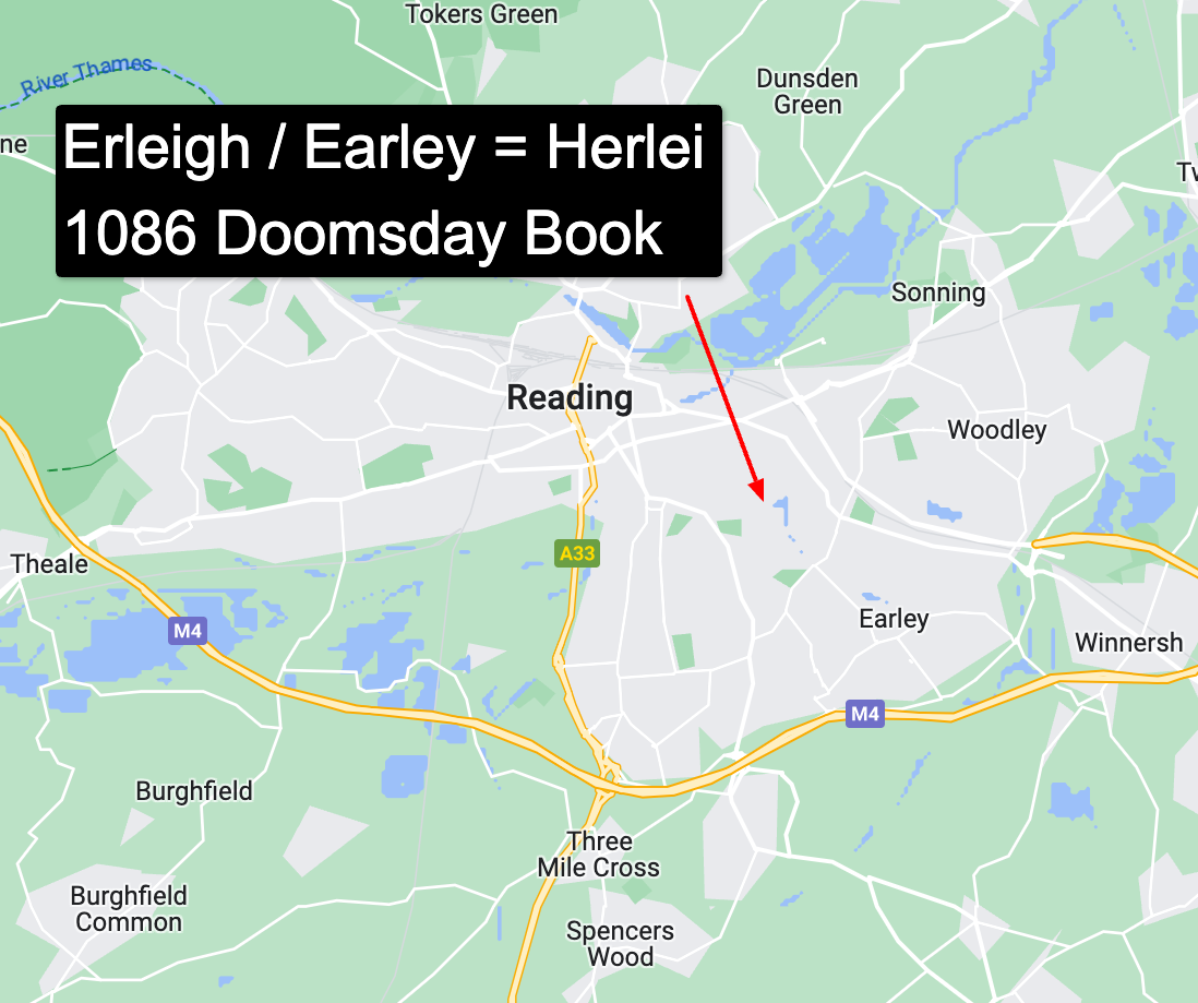
The land in Berkshire called “Herlei” in the 1086 Domesday Book is modern-day Earley.

In the Domesday Book Record the land called Erleigh was referred to as the “LIBERTY of Herlei, xi cent.; Erleye, Ere, Erlegh, xiii cent.; Early, Erleigh, xiv cent.; Arley, xvi cent.
The word “Liberty” formerly meant “an area free of County control,” signifying exemption from the jurisdiction of the County Sheriff and (often) a separate commission of the peace. Among the best-known examples of active ancient liberties are the Liberty of the Soke of Peterborough and the Liberty of Hexham or Hexhamshire. Closer to London, certain anomalous liberties, like the Mint in Southwark or the precinct of the Savoy in Westminster, existed as sanctuaries or “no-go areas” for the sheriff and other legal officers – where felons could go unmolested.
Liberties were creations of medieval times or earlier, and ecclesiastical liberties are likely to have operated independently of their parishes in the remote past. It is possible, for example, that the Liberty of Earley in early medieval times paid its tithes not to Sonning Church but to the Abbot of Reading. By our period, however, “liberty” appears to have signified little more than a parish subdivision, usually having no church of its own.
The Liberty of Earley extended from the River Thames to the River Loddon and included a sizeable part of what is now east Reading and most but not all of present-day Earley.
Modern landmarks that lie within the boundaries of the Liberty of Earley include the Thames Valley Business Park (formerly Sutton’s Industrial Estate) beside the River Thames; the Cemetery Junction area, including the Marquis of Granby Inn (formerly known as the Gallows Tavern) and Granby Gardens; all of present-day Newtown to the east of Cumberland Road; Palmer Park; the site of Alfred Sutton Primary School and the former Alfred Sutton Secondary School; the site of the new mosque on Green Road; the area known as Mockbeggar; most, but not all, of the University of Reading Whiteknights campus; Church Road and the area around Earley St Peter Church; Maiden Erlegh School; much of the Lower Earley residential development (although not the Kilnsea Drive area in the south-east, which was in the Liberty of Woodley and Sandford); and the Loddon Valley running down towards Shinfield Grange.
